Visitors 81
Modified 4-Jan-24
Created 23-May-10
50 photos
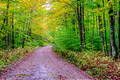
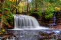
These directions are taken from Eric Hansen’s Hiking Michigan’s Upper Peninsula with some additional comments. If you want to find this waterfall it is important that you use your mileage gage. The forest roads are dirt, rocky and in some places single tracks but they are passable. Starting at Chatham, drive 3.3 miles north on Rock River Road. Turn left (west) on Forest Road 2276 (also known as Sandstrom Road). Note that the numbers on the FR sign are not readable but the turn is about .1 mile after you cross the Rock River. Drive 3.6 miles on FR 2276 and turn left (south) on FR2293. Drive 0.7 miles on FR 2293 at which point you will see a small (2 car) parking area on your left. There are no signs for the falls or the trail. The trail starts directly in front of your car (west).
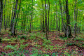
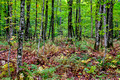
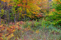
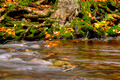
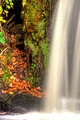
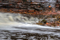
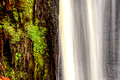
Note that the trail is quite boggy in spots and you would do well to wear some rubber boots. These are also helpful if you are going to be doing photography since some of the best shots require wading in the stream.
© Philip Schwarz Photography